Photo Documenting Recent Changes in the Southwestern Corner of Old City Jerusalem
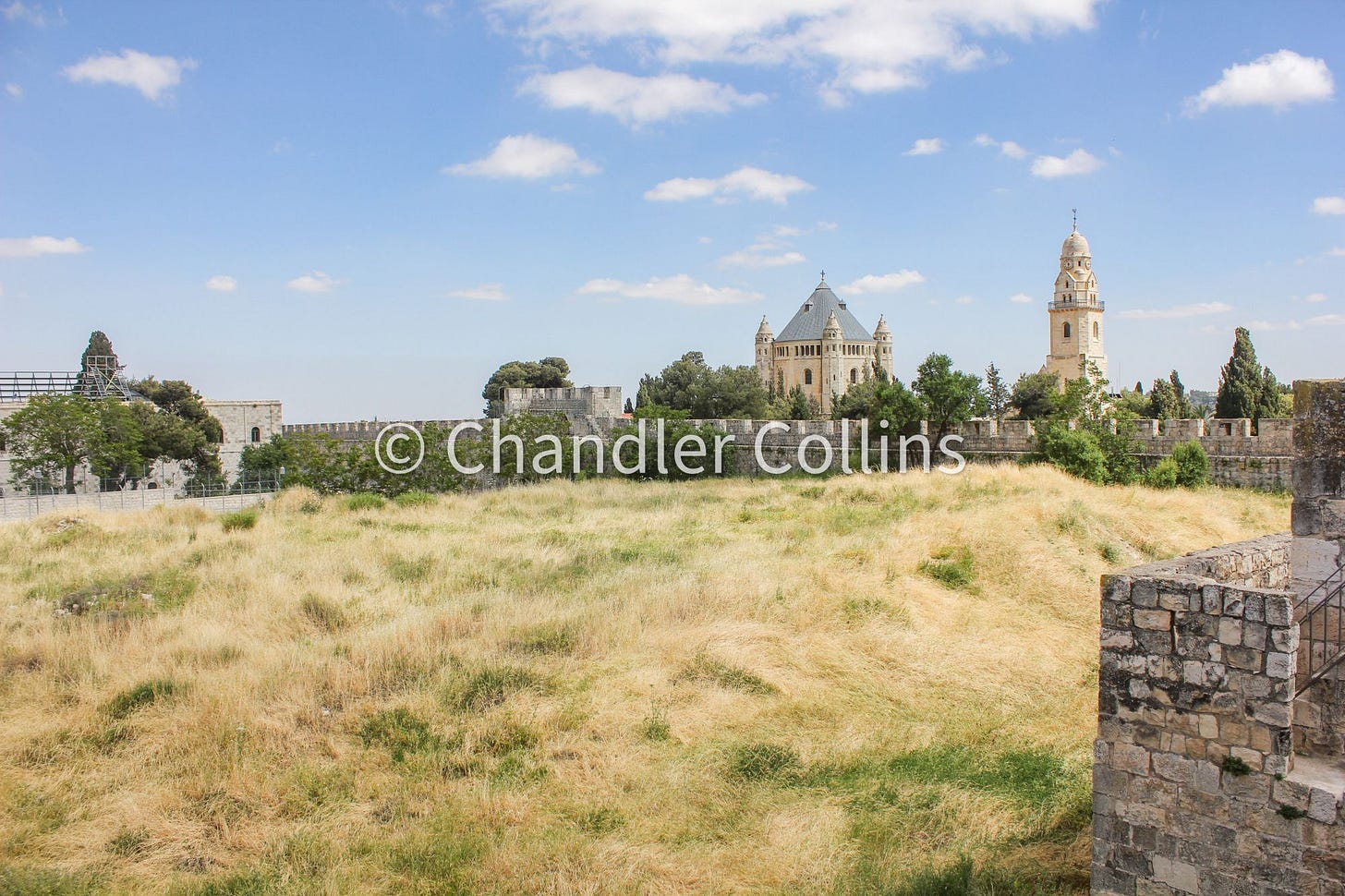
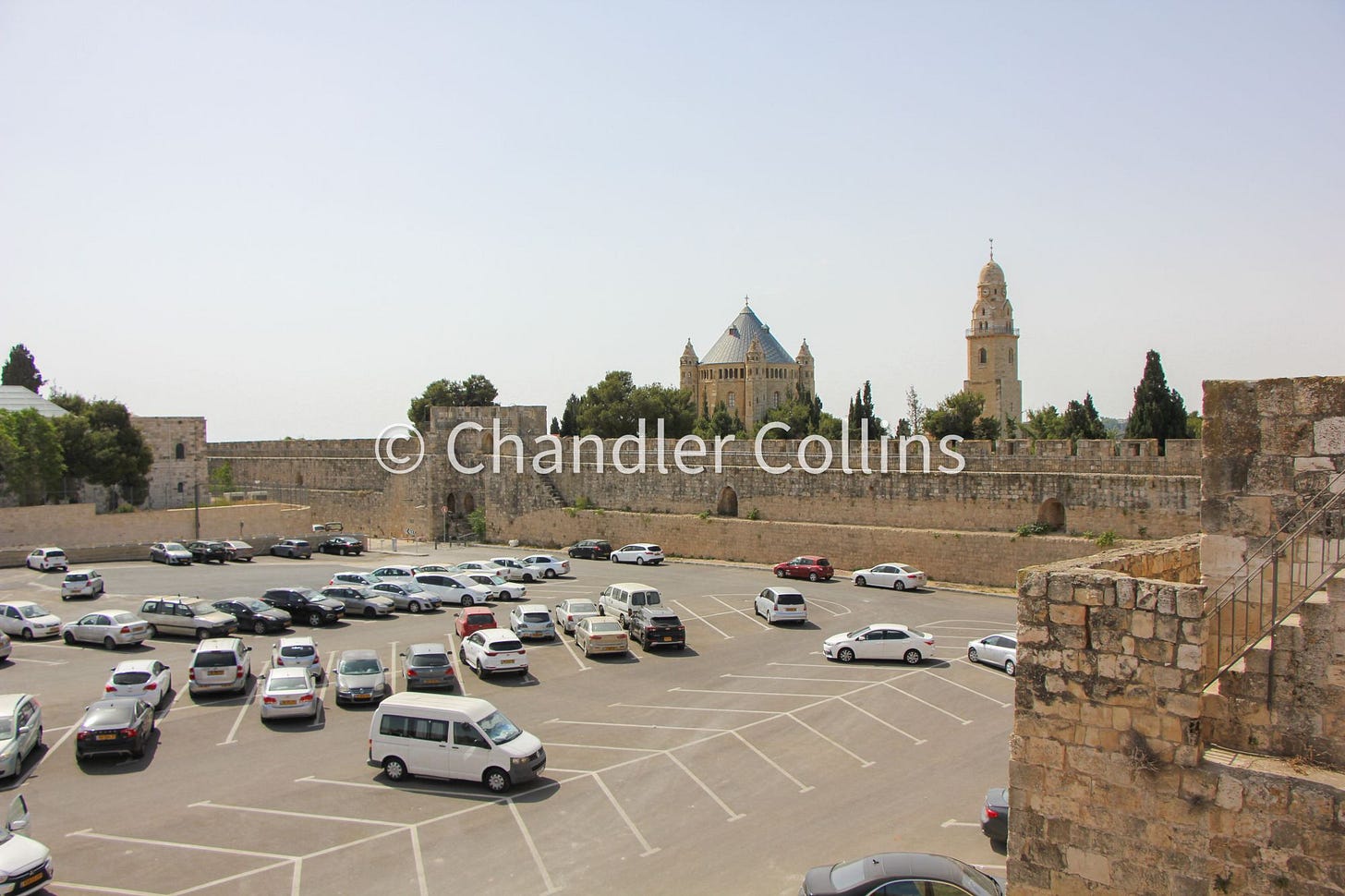
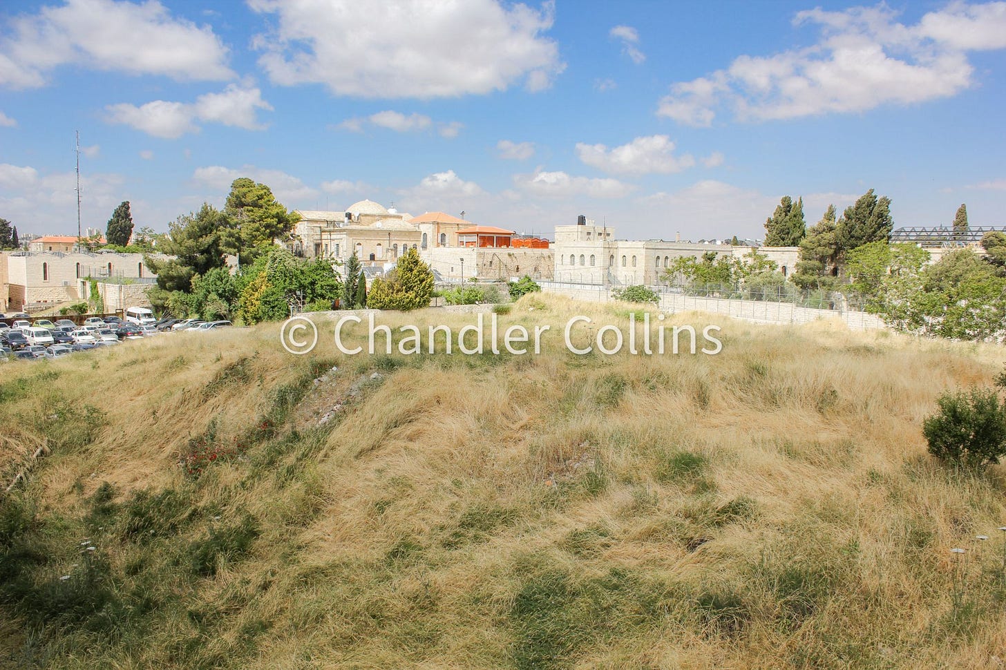
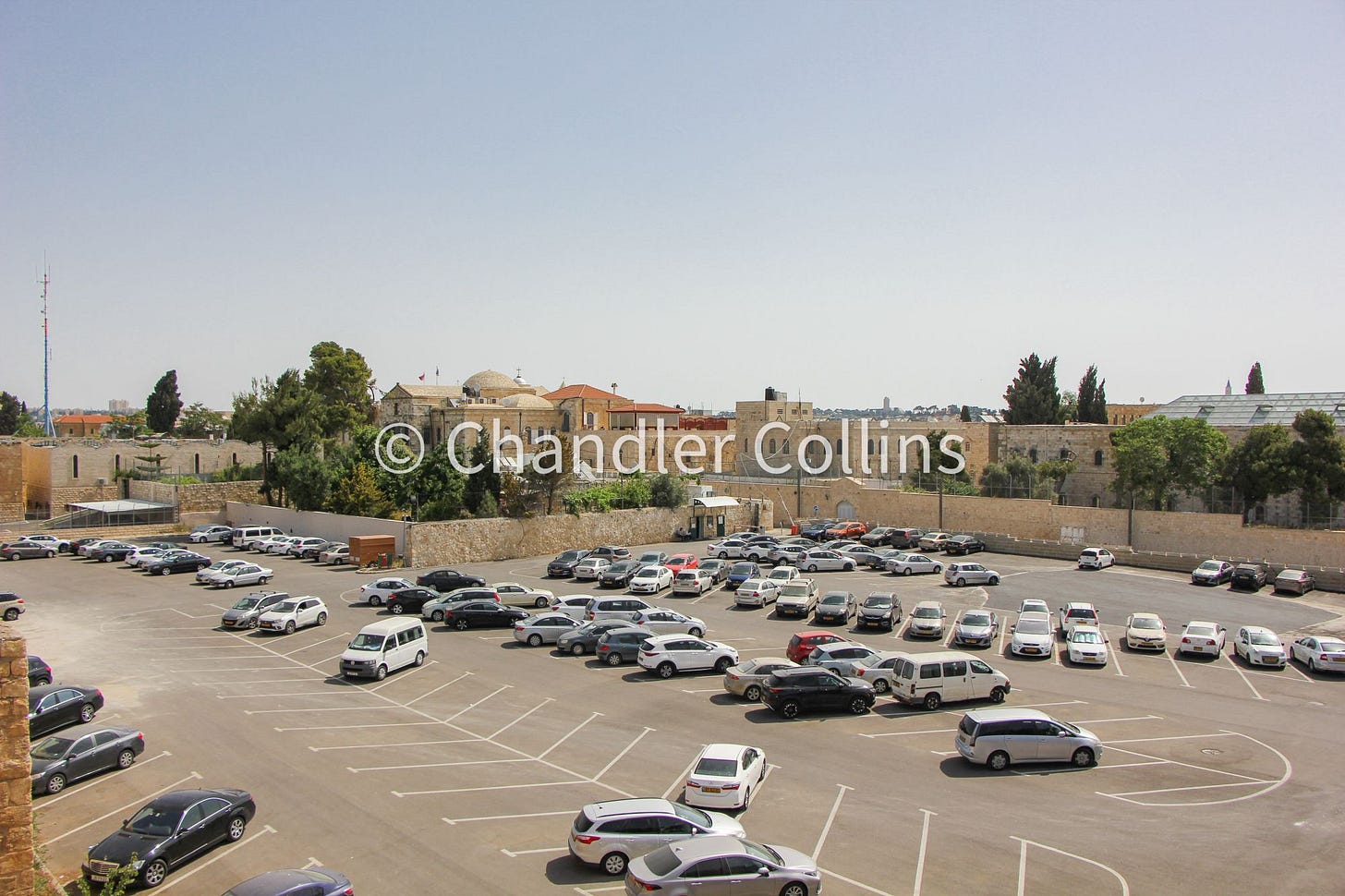
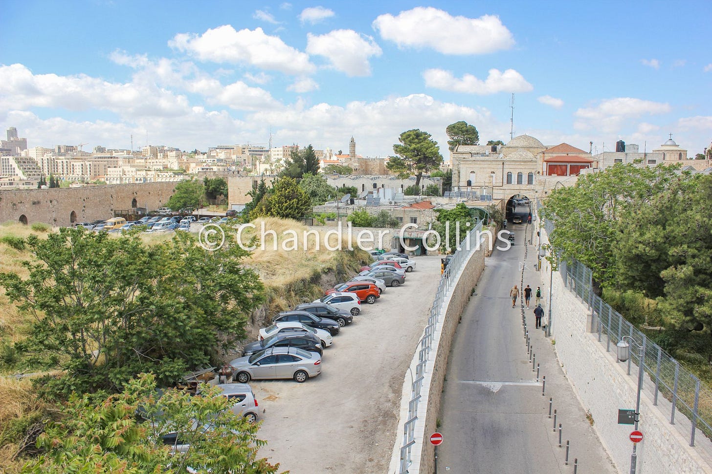
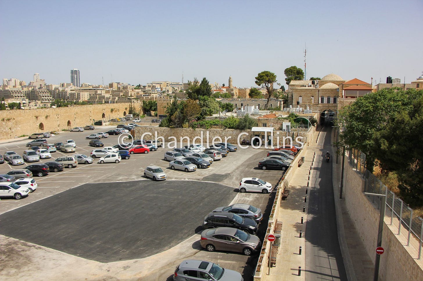
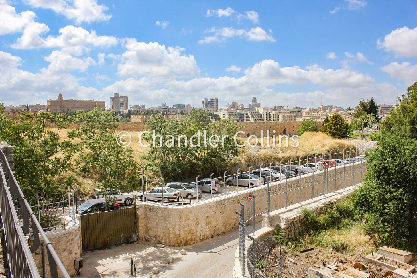
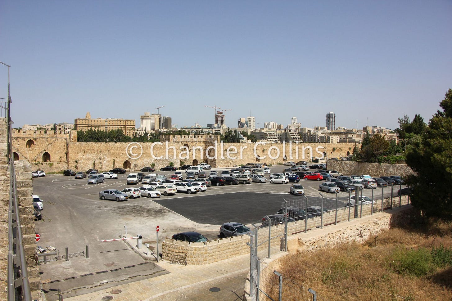
During the pandemic a major effort that included salvage excavations transformed the southern Armenian Garden from a mound of dirt into a large paved parking lot. Here is what changed.
If you find this newsletter valuable, consider upgrading to a paid subscription
One of my favorite things to do in Jerusalem is enjoy an early morning walk with my camera in hand (and also preferably, a cup of coffee). These outings allow me to watch the city come alive and notice changes unfolding in the landscape and architecture. Over the course of several walking trips, I began to pay close attention to a major ongoing project in the southwestern corner of the Old City: the expansion of the parking lot in the southern Armenian Garden, including the removal of a massive pile of dirt and a salvage excavation. The project began in the fall of 2020 (while the country was closed during the pandemic) and continued throughout 2021.
Removing a conspicuous pile of dirt
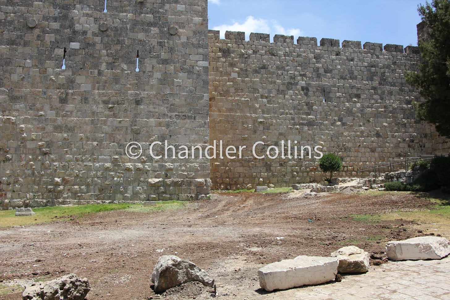
A vertical chute built against the southwestern side of the Old City wall was the first major sign of development. A small pile of dirt soon appeared below it and continued to grow over the coming days and weeks. This dirt was being moved from a conspicuous mound on the inside of the Old City wall.

This large mound, clearly visible from the top of the Old City walls, has always been intriguing to me. Where did it come from, and how long has it been sitting there? Records of the Armenian Patriarchate show that they acquired this area and turned into a garden in the 17th century.1 Early modern maps of Jerusalem, such as Wilson’s below, label it as a garden or simply leave it as empty white space. Its recent state, hardly qualifying as a garden, suggests that the dirt pile post-dates these 19th-century maps.
From 1962-1967 Kathleen Kenyon and A.D. Tushingham excavated in the southwestern corner of the Old City, labeling it Site L (see map below).2 Kenyon reports that debris removed during the work was carried off with the help of the Deccaville railway, a portable railway station used in early excavations, which they rented from the Ecole Biblique.3 She does not mention how far away the soil was taken, but Tushingham notes that the entire area was backfilled after their excavation4 (presumably with the same soil that originally filled it).
Photos from Kenyon’s interim reports in PEQ and Tushingham’s final report show that our mound of interest did not exist prior to her dig. I am aware of only two nearby projects that have taken place since her excavations that were were big enough to produce a high volume of debris: Magen Broshi’s excavations and the building of the new Armenian seminary. Both projects took place in the northern part of the Armenian Garden. Perhaps dirt from one or both these projects (or some other) was dumped here after 1967. Wherever it came from, it is clear that the mound originated elsewhere, was recently deposited, and did not contain any architectural remains.

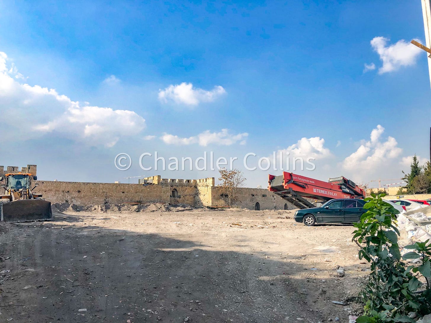
Workers removed the sprawling mound of dirt from the southern Armenian Garden with large machinery and dumped it intermittently over the Old City walls until the entire parking lot area became level. The soil was taken to an unknown location from the end of 2020 to the beginning of 2021.
While investigating some of the dirt that had accumulated outside the Old City wall, I noticed archaeologically recoverable materials such as pottery and other small finds. Most seemed to be of a fairly recent date, but it also included what looked to me like Roman or Byzantine sherds (unfortunately I did not take photos). It would be interesting to know exactly where this material originated and if it was taken somewhere to be examined or sifted. Once all the dirt had finally been removed, the space where it sat was covered with fresh sod and returned to its previous visual state.
A salvage excavation
Once the mound of dirt inside the parking lot was removed, the Israel Antiquities Authority began a salvage excavation in two main areas (see map above) to a depth of no more than a few meters. I was unable to see bedrock in either area. Visible in the western portion of the excavations was a large building with white mosaics, ovens, and tile floors sitting almost immediately below the level of the parking lot. On the eastern side and at a greater depth was what I understood as a different building with multiple phases. More ornate mosaics were uncovered there.
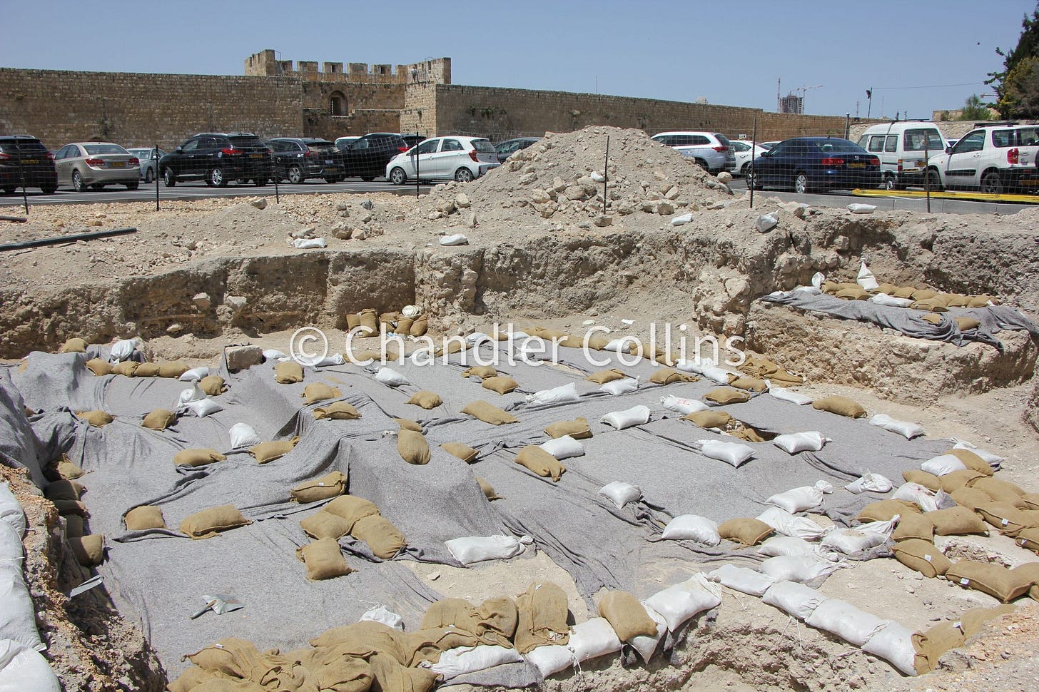
The location of this excavation on top of the Western Hill is intriguing since it is known to have housed both the second Crusader palace and the palatial complex of Herod the Great. How far south Herod’s palace stretched from today’s Jaffa Gate is a matter of debate among scholars,5 but this excavation has the potential to help to settle the issue. Gaining any architecture at all from the palace buildings proper would also be a major contribution. The only known remains to date are a few subterranean walls and the fill between them that supported a large podium on which we assume Herod’s palace was constructed.6
This excavation could also contribute to the question of whether this area was settled and/or walled in the Iron Age after the city’s expansion onto the Western Hill.7 However, I don’t believe it went deep enough to address either of these lingering historical questions before it was paved over (I hope I am wrong).
In her nearby excavation, Kenyon found a large 14th-century CE Mamluk building sitting directly over a Byzantine Church. One wonders if the stratigraphy from the IAA excavation will mirror that of Kenyon’s Site L. Perhaps the large western structure uncovered by the IAA was an extension of the Site L Mamluk building or another one entirely. The more ornate mosaic and its associated building(s?) in the deeper excavation area may be part of a Byzantine structure. We will wait eagerly for the excavation report which will supply dates for these buildings, as well as other important details and perhaps a few surprises.

Changing a corner of the Old City
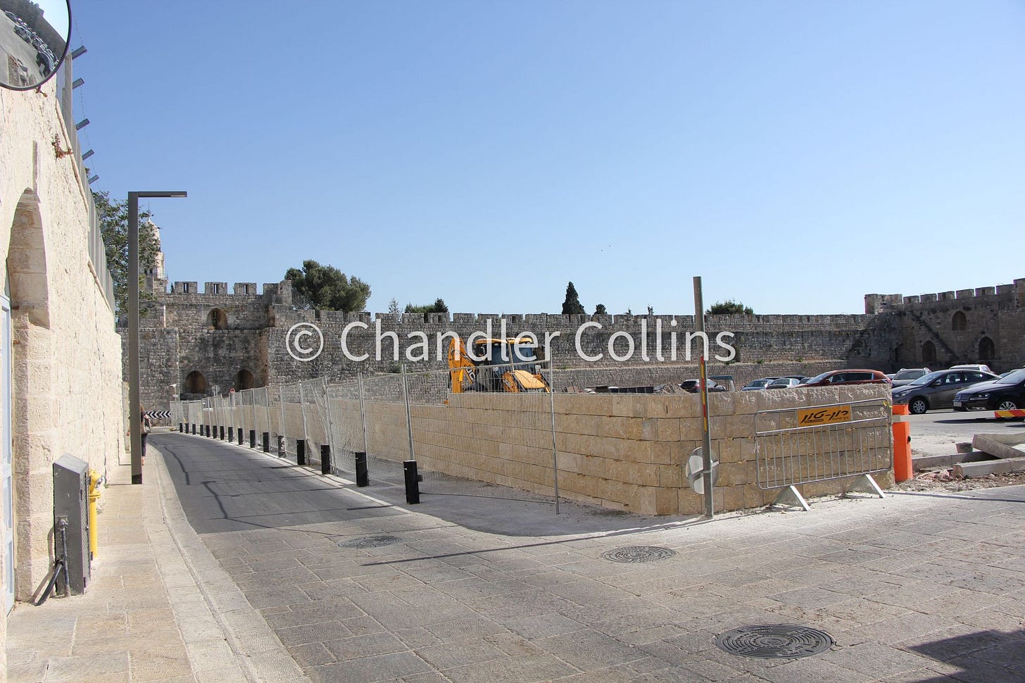
As a part of the project, the older stone wall built along Armenian Patriarchate Street was knocked down and rebuilt in truncated form. Today the wall stands about half the height of the previous one with flower planters on top.
The excavations were filled in and paved over to complete the remaking of this area into an expanded parking lot with over 180 spaces. And so another corner of Jerusalem has been transformed (but not without some controversy).8
You will be sure to notice this new development whether you view the parking lot while passing by on Armenian Patriarchate Road or looking down from the walls above. These photos from the ramparts show how dramatically different the area looks today when compared to the same views from just a few years ago.
This excavation took place during the years of Divided Jerusalem. Kenyon describes Jordanian soldiers positioned nearby on the Old City walls and Israeli soldiers looking down on them from the bell tower of Dormition Abbey.
See Re’em 2018:244-248. The details from Josephus give us some architectural details but not enough information to know the size of the Herod’s palace. One argument that it extended as far south as the modern Old City wall has to do with the very level topography from roughly the Ottoman citadel running south (obvious to anyone who walks down Armenian Patriarchate Street). Many presume that this is due to the underlying artificial platform that held up the palace complex, but this is not certain. The Western Hill continues south from there for some distance at a very similar elevation.
The archaeological interpretation of Herod’s palace impacts how we understand the small gate from the Early Roman Period found by Magen Broshi outside the Old City walls (called the “hidden gate” on the signage). Was this a private entrance to Herod’s palace? Maybe and maybe not.
Orit Peleg-Barkat argues that Herod’s palace may have spread further east than has usually been thought based on monumental columns and capitals found downslope in Avigad’s Jewish Quarter excavations. I am not convinced that these architectural fragments should be related to Herod’s palace, but they are an otherwise very interesting enigma.
Recent excavations by the German Protestant Institute of Archaeology in the Protestant Cemetery have brought this question back to the fore. They were able to show that a line of fortifications discovered by Bliss and Dickie in the 1890s does not date to the Iron Age as was believed by Bargil Pixner (and assumed by many others, myself included). The question of how far south Jerusalem’s Iron Age walls were built, therefore, remains unanswered archaeologically. The nearby UNC Mount Zion excavation uncovered evidence of the destruction of Jerusalem in 586 BCE by the Babylonians. We await further details about these remains and what they can tell us about the extent of Iron Age Jerusalem.
Any development in East Jerusalem will continue to be problematic until a final status for the city is achieved. In this case, the Armenian Patriarchate accepted funding from the Jerusalem municipality to create an expanded parking lot which is to be used by Jewish and Armenian residents of the Old City. Upon completion, the parking lot was leased (for 99 years) to a company based in the UAE which is owned by Australian Jewish businessman Danny Rubenstein. He reportedly plans to build a hotel on the property. See more details here, here, and here. The Armenian Patriarchate responded to these issues here and here.
Enjoy this post?
Show your appreciation by leaving a tip as low as the price of a cup of coffee.
Follow Approaching Jerusalem
View previous editions of this newsletter or follow us on social media for archaeological stories, upcoming lectures, and other Jerusalem-related news, resources, and analysis.




I have visited Jerusalem a few times and always wondered about this area. I never did get back to researching it. Sad to see it change, but appreciate the info and especially the photos. A real blessing. Thanks.
Another great read Chandler. I really appreciate your careful and clear writing style with the detailed points of orientation. The depth of information you provide is always objective and enlightening, but presented in such that a novice like me can understand. The “before and after” photos are extremely helpful. I enjoyed learning about this in your class and your article has helped me greatly. As you said, I wish the team could have gone deeper.