Jerusalem in Brief (No. 6)
Today's Brief highlights the Hinnom Valley in the 19th century, an original guide to Avi-Yonah's Jerusalem model, a correction to a previous post, and upcoming events on historical Jerusalem.
If you find this newsletter valuable, consider upgrading to a paid subscription and receive unique Jerusalem-related benefits.
Jerusalem visualized

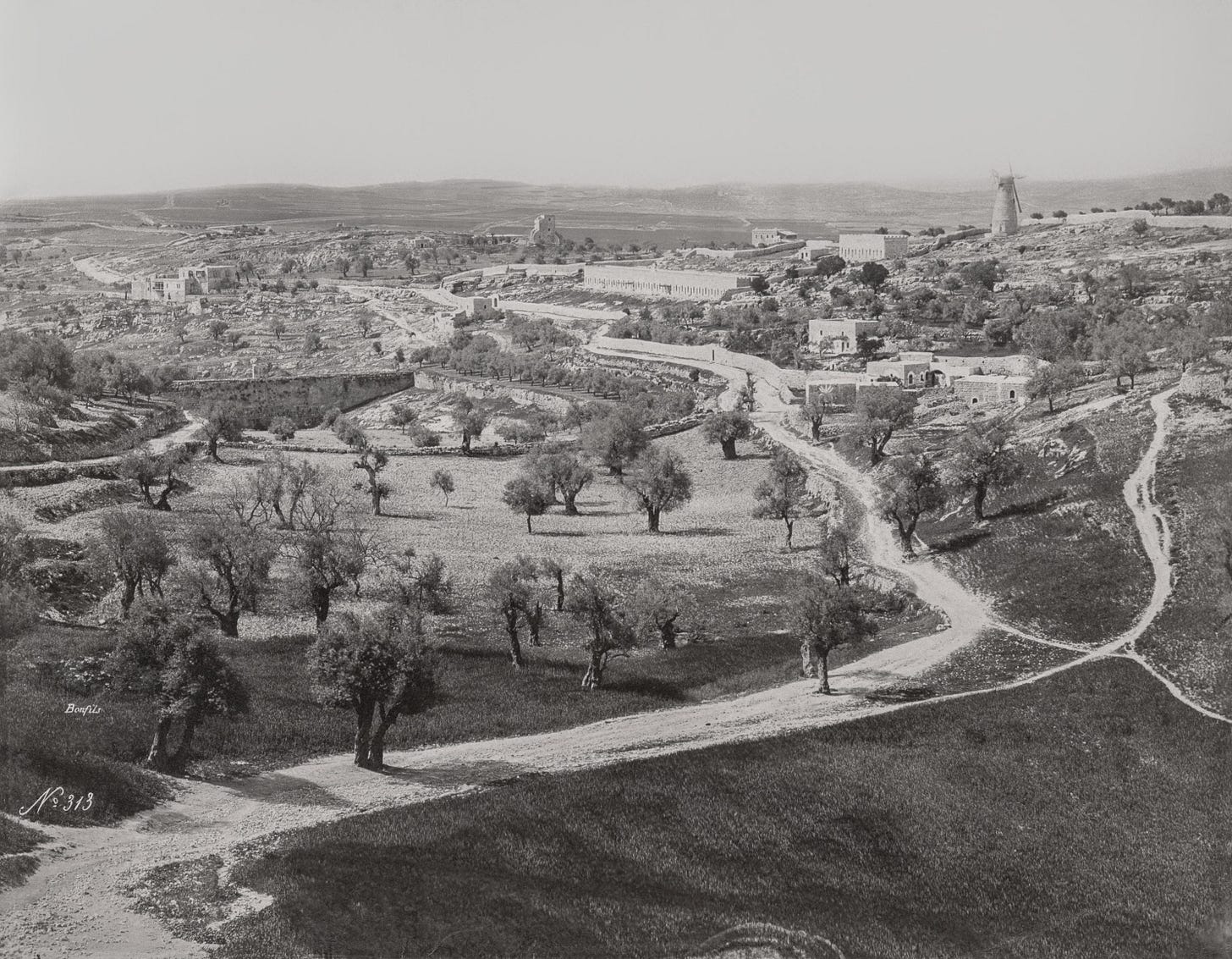
The photo above was taken by Félix Bonfils, a prominent early photographer in the Eastern Mediterranean, sometime between 1867 and his death in 1885. It was published as part of a later collection in 1894. The photo’s perspective highlights the Hinnom Valley (Wadi er-Rababi), looking south from the slopes outside Jaffa Gate.
Olive trees dot the terrain, appearing not only in the bottom of the valley where they benefited from rain runoff, but also on the slopes above. Their distribution indicates an intentional use of the land outside Jerusalem during the Ottoman Period. These trees are also reflected in contemporary photographs, maps, and sketches going back several decades in time. The large size of most trees suggests they had stood in the western area outside the city for some time.
The presence of these perennial fruit trees conflicts with reports by many early modern travelers that describe an infertile landscape around Jerusalem. This dissonance is heightened by the the approach of most travelers toward Jerusalem from the west side of the city. Several factors probably influenced the impressions of these transient visitors, some of which I have detailed here and here. To them, we may add the European association of productive agriculture with the monocropping of annual plants, particularly grains. Other areas of Jerusalem do seem to have been used as garden plots for annual crops at this time.
The topography curves toward a depression in the center left and appears to stop abruptly at a dam wall for the Sultan’s Pools (Birket es-Sultan). The dam collected runoff from seasonal rains, forming a pool here during the winter months. Scholars have debated the time when it was first constructed, which (as far as I know) is still unclear. At the time of Bonfils, it was regularly identified as the Lower Pool of Gihon, reflecting the belief that it dated back to the days of the Judahite Monarchy. This is one of many historical interpretations connected with the belief that Jerusalem’s ancient core was located on the Western Hill (off the photo to the left). At the end of the Ottoman Period, the Friday animal market was located at this pool (Hanauer 1910:24).
A stone street ran across this dam wall, which continues to serve as a (paved) road today. The projecting bump in the center of the wall is a sabil (water fountain). A small bridge that cuts across the valley is visible at the center left, between the dam and the road at the bottom of the photo. This bridge, which is no longer visible today, carried Jerusalem’s lower aqueduct across the Hinnom Valley. It is commonly believed to have been constructed during the time of the Hasmonean Kingdom in order to convey water to the Temple Mount. In 1901, the Ottoman government gave special attention to these water systems, renovating the aqueduct and establishing a new sabil near Jaffa Gate. A large public ceremony celebrated the inauguration of the new waterworks (Lemire 2017:98-101).
The long building at the top center and its smaller counterpart upslope belong to Mishkenot Sha’ananim. This is famously known as the first permanent Jewish settlement in Jerusalem outside the city walls. It was funded by the British philanthropist Moses Montefiore, whose name remains attached to the windmill at the top right. The buildings are still set apart on the Jerusalem skyline today by their horizontal stance and pronounced crenellation. These large buildings fill a largely empty landscape and remind us of this era in Jerusalem’s history, when structures built outside the Ottoman city were part of walled compounds. The best example of this phenomenon is the Russian Compound. Yemin Moshe, the adjacent neighborhood to the north in Jerusalem today, had not yet been built at the time of this photo.
The area at the far right of the photo was purchased in the 1890s by Nicoforus, the secretary to the Greek Orthodox Patriarch. Afterward, it became known as Nicoforia (Arnon 1992:32). The Palestinian Christian oudist Wasif Jawhariyyeh, whose dairy entries have recently been published, lived in Nicoforia as an adult until he fled Jerusalem on April 18, 1948. He curated and displayed an interesting collection of objects in his house. He also describes visiting his Jewish neighbors to the south in "Montefiore" for evening parties along with other Arab Jerusalemites of prominent families (Tamari and Nassar 2014:114-115).
Notes & quotes
Prior to the development of Jerusalem’s extramural neighborhoods in the mid-19th century, it was common practice for the city gates to be closed at night and opened in the morning. In his 1908 book Ancient Jerusalem, the American consul Selah Merrill reflected back on this practice which by then had ceased. The excerpt below dovetails well with the geography captured in Félix Bonfils’ photo above. Merrill mentions institutions along the city’s entire western side, from the Bishop Gobat School in the south to the Russian Compound in the north. Merrill did not live in the city during the time he describes and must relay this information from other sources. Perhaps a loud voice could indeed be heard across such distances then. Today, it would certainly be flooded out by the sounds of traffic.
“In former times when the gates of the city were closed at night, a watchman was stationed outside the Jaffa Gate about half-way between it and the northwest corner of the city wall, whose duty it was to call out that the gate was to be shut. This he did ten or fifteen minutes before the time of closing, that any person who was outside might be warned and come in. Then it was not safe to remain overnight outside the walls. On all pleasant afternoons the people, then as now, flocked to the slopes east and west of Birket es Sultan and to the so-called Nicoforieh olive groves. As soon as the call was heard everybody hastened to return to the city. This custom continued until thirty-five or forty years ago. There were then no houses outside the walls and no buildings built against them as at present. There was nothing to obstruct the crier's voice, which rang out across the valley and could be heard distinctly at Bishop Gobat's School, Birket es Sultan, the Nicoforieh olive groves, Birket Mamilla or the Upper Gihon, and round as far as the east side of the Russian grounds. In clear weather his voice could be heard for 2,000 or 2,500 feet ; and at a distance of 1,200 or 1,500 feet his words, without any effort on his part, could be easily understood.” (Merrill 1908:275)
Corrections
In April, I wrote an analysis of an excavation at Dar al-Consul, near the center of the Old City, where an Iron Age II tomb was recently discovered. In the conclusion I offered the following sentence: “As far as I know, this is the only undisputed Iron Age II tomb that has been revealed within the confines of the Old City.”
Shortly thereafter, it was brought to my attention by Gordon Franz (via Todd Bolen of BiblePlaces.com) that Gabriel Barkay had already detailed another likely Iron Age II tomb within the Old City walls in his 1985 dissertation. It was found by a Coptic priest in 1885 below the Coptic Monastery in the northeastern part of the Holy Sepulcher. The priest then showed it to Conrad Schick who published it that year. Although pottery did not accompany the rock-cut tomb, its U-shaped style fits the time of the Judahite Monarchy (Iron Age II), and other scholars agree with this assessment (Gibson and Taylor 1994:54). Therefore, it is likely that at least two tombs from this period have been found to the north of the Transversal Valley but inside the current Old City walls. I’m grateful for this feedback!
Recent arrivals
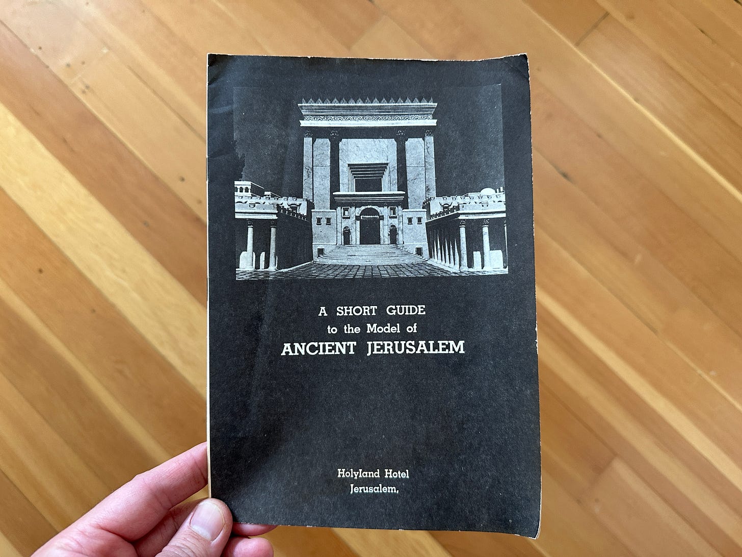
While perusing eBay, I was fortunate to find a copy of what I believe to be an original guidebook to the famous model of 66 CE Jerusalem that is today housed at the Israel Museum. It was originally constructed for display at the Holyland Hotel under the academic advisory of Michael Avi-Yonah. This guidebook was published in 1966, when Jerusalem was still divided between Israel and Jordan and before any largescale Israeli excavations in the historical basin had begun.
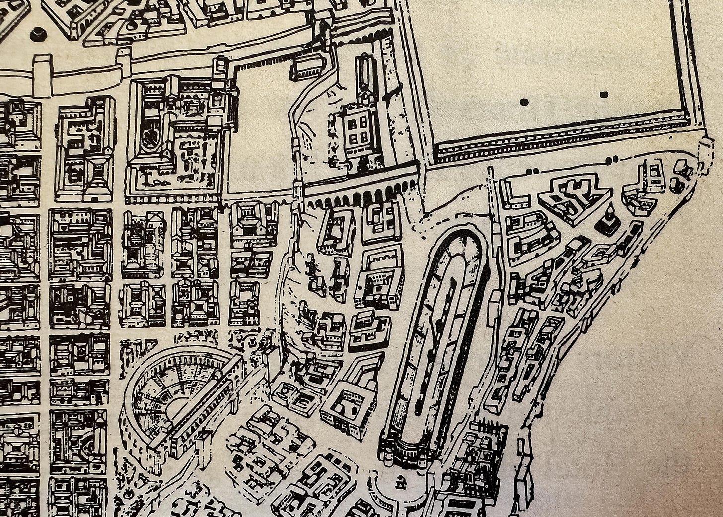
Avi-Yonah’s model is a collation of historical scholarship on Jerusalem until the late 1960s and reflects certain archaeological interpretations of that period. Some aspects were altered either by Avi-Yonah until his death in 1974 or prior to the model’s installment at the Israel Museum. This short, 15-page guidebook of the original model provides some insight into these changes. Interestingly, Avi-Yonah originally adopted the longstanding interpretation pioneered by Edward Robinson that the spring of an arch at the southwestern corner of the Herodian Temple Mount led to a bridge described by Josephus that ran across the Central Valley. The bridge on Avi-Yonah’s model was later removed and replaced with a series of steps after Benjamin Mazar’s excavations provided more archaeological context (I wrote about this here). Among other alterations, the superstructure of the hippodrome has also been completely removed.

Fall course
Starting on Monday September 9, I will be teaching Biblical Jerusalem and Its Explorations, an online semester course offered through Jerusalem University College. Over twelve lectures, we will explore ancient Jerusalem at key historical periods from the earliest city until its destruction by Rome in 70 CE. The class will also present an introduction to Jerusalem’s geography and basic historical sources. We will meet live on Monday nights from 8:00-10:30 PM ET. Students can register for credit or audit. More information is available here.
Upcoming (digital) events
September 4, 7:00 PM ET - Jodi Magness will be offering the lecture “What Makes Jerusalem Special?” The free virtual event is sponsored by the Friends of ASOR. Read more and register here.
Paid supporters
The next Approaching Jerusalem livestream will take place on Tuesday September 17 from 8:00-9:30pm ET.
During these events, we discuss excavations, publications, pop media articles, and developments relevant to historical Jerusalem. I also share resources and occasionally present original research. Participants will have the opportunity to ask questions. Paid subscribers get access these quarterly events and the archive of previous recordings.
Enjoy this post?
Show your appreciation by leaving a tip as low as the price of a cup of coffee. Less than 1% of readers do this, and it makes an enormous difference.
Follow Approaching Jerusalem
View the newsletter archive and follow Approaching Jerusalem on social media for archaeological stories, upcoming lectures, and other Jerusalem-related news, resources, and analysis.


